This wiki is no longer being updated as of December 10, 2025.
|
GeoCoder Object: Difference between revisions
Jump to navigation
Jump to search
No edit summary |
No edit summary |
||
| Line 48: | Line 48: | ||
*[[Media:DQT_API_DQS_PlatformMatrix.pdf|Supported Platform Matrix]] | *[[Media:DQT_API_DQS_PlatformMatrix.pdf|Supported Platform Matrix]] | ||
*[[Media:DQT_API_FactSheet.pdf|API Capabilities]] | *[[Media:DQT_API_FactSheet.pdf|API Capabilities]] | ||
<h3>Results Codes</h3> | <h3>[[Results Codes]]</h3> | ||
*[[GeoCoder Results Codes]] | *[[Results Codes#GeoCoder|GeoCoder Results Codes]] | ||
<h3>Sample Code</h3> | <h3>Sample Code</h3> | ||
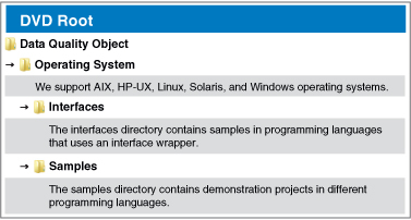
*All sample code may be found on the on the Data Quality Suite DVD, download, or demo. If you would like to request a DVD or talk to a representative please call 1-800-MELISSA extension 3. | *All sample code may be found on the on the Data Quality Suite DVD, download, or demo. If you would like to request a DVD or talk to a representative please call 1-800-MELISSA extension 3. | ||
Revision as of 22:59, 18 July 2013
 GeoCoder Object enables you to access geographic data using your ZIP Code™ and optional Plus4. This allows you to obtain latitude and longitude geographic coordinates, census tract and block numbers, as well as county name and FIPS numbers.
| ||||||

| ||||||
 |
 Documentation
Results CodesSample Code
 | |||||