This wiki is no longer being updated as of December 10, 2025.
|
GeoCoder Object: Difference between revisions
Jump to navigation
Jump to search
No edit summary |
No edit summary |
||
| Line 1: | Line 1: | ||
__NOTOC__ | __NOTOC__ | ||
{ | {{ProductV2 | ||
|ProductImage=[[File:TILE_API_GeoCoderObject.png|link=]] | |||
{ | |ProductBody= | ||
| | |||
| | |||
GeoCoder Object® enables you to access geographic data using your ZIP Code™ and optional Plus4. This allows you to obtain latitude and longitude geographic coordinates, census tract and block numbers, as well as county name and FIPS numbers. | GeoCoder Object® enables you to access geographic data using your ZIP Code™ and optional Plus4. This allows you to obtain latitude and longitude geographic coordinates, census tract and block numbers, as well as county name and FIPS numbers. | ||
|CurrentBody= | |||
| | |||
<h3>Current Build</h3> | <h3>Current Build</h3> | ||
Released June 2017 | Released June 2017 | ||
<br>Build 2961 | <br>Build 2961 | ||
*[[Build History:GeoCoder Object|Build History]] | *[[Build History:GeoCoder Object|Build History]] | ||
<h3>Notices</h3> | <h3>Notices</h3> | ||
*[[Issues:GeoCoder Object|Known Issues]] | *[[Issues:GeoCoder Object|Known Issues]] | ||
*'''[[GeoCoder Object:Notice|Important Advisory]]''' | *'''[[GeoCoder Object:Notice|Important Advisory]]''' | ||
|EssentialsBody= | |||
| | |||
<h3>Basics</h3> | <h3>Basics</h3> | ||
*[[API:Best Practices|General API Best Practices]] | *[[API:Best Practices|General API Best Practices]] | ||
| Line 41: | Line 25: | ||
<h3>[[Service Samples|Service Sample]]</h3> | <h3>[[Service Samples|Service Sample]]</h3> | ||
*[http://www.melissadata.com/lookups/geocoder.asp Try the service] | *[http://www.melissadata.com/lookups/geocoder.asp Try the service] | ||
|ReferenceBody= | |||
| | |||
<h3>Documentation</h3> | <h3>Documentation</h3> | ||
*[[Media:DQT_API_GeoCoder_QSG.pdf|GeoCoder Object Quick Start Guide]] | *[[Media:DQT_API_GeoCoder_QSG.pdf|GeoCoder Object Quick Start Guide]] | ||
| Line 56: | Line 35: | ||
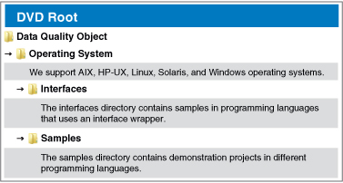
[[Image:DQT_API_SampleCode.jpg|Sample Code]] | [[Image:DQT_API_SampleCode.jpg|Sample Code]] | ||
}} | }} | ||
[[Category:API]] | [[Category:API]] | ||
[[Category:GeoCoder Object]] | [[Category:GeoCoder Object]] | ||
Revision as of 23:49, 2 May 2018
 GeoCoder Object® enables you to access geographic data using your ZIP Code™ and optional Plus4. This allows you to obtain latitude and longitude geographic coordinates, census tract and block numbers, as well as county name and FIPS numbers.
|
 |


