This wiki is no longer being updated as of December 10, 2025.
|
Unison:US Address Verification: Difference between revisions
Jump to navigation
Jump to search
No edit summary |
No edit summary |
||
| (8 intermediate revisions by the same user not shown) | |||
| Line 1: | Line 1: | ||
{{ | {{UnisonNav | ||
|ServicesCollapse= | |ServicesCollapse= | ||
}} | }} | ||
| Line 6: | Line 6: | ||
{{CustomTOC}} | {{CustomTOC}} | ||
The | The Unison by Melissa Address Object cleanses contact data. | ||
[[File: | [[File:UNI_Projects_AddressUS_Button.jpg|link=|300px]] | ||
==Input Fields== | ==Input Fields== | ||
[[File: | [[File:UNI_Projects_AddressUS_InputFields.jpg|link=|800px]] | ||
This section displays the possible inputs for the Address Service. An address and ZIP code are required. | This section displays the possible inputs for the Address Service. An address and ZIP code are required. | ||
;Last Name | |||
:The last name of the individual associated with the address. | |||
;Company | |||
:The company or organization. | |||
;Address | |||
:The first address line. | :The first address line. | ||
;Address 2 | |||
:The second address line. This is optional and can contain a suite or a different secondary address, like a P.O. Box. | |||
;Suite | |||
: | :'''Sub-Premises'''. The suite number. | ||
;City | |||
:The city name. | :'''Locality'''. The city name. | ||
;State/Province | |||
:'''Administrative Area'''. The state or province name. | |||
;Zip/Postal Code | |||
:The five-digit ZIP Code, the first five digits of a ZIP+4, or a full nine-digit ZIP+4. | :The five-digit ZIP Code, the first five digits of a ZIP+4, or a full nine-digit ZIP+4. | ||
;Plus 4 | |||
:The last four digits of a ZIP+4. | :The last four digits of a ZIP+4. | ||
;Country Code | |||
:The country code. | :The country code. | ||
;Urbanization (Puerto Rico) | |||
:Only used for addresses in Puerto Rico. This is used to break ties between similar addresses in the same Postal Code. | :Only used for addresses in Puerto Rico. This is used to break ties between similar addresses in the same Postal Code. | ||
==Output Fields== | ==Output Fields== | ||
[[File: | [[File:UNI_Projects_AddressUS_OutputFields.jpg|link=|800px]] | ||
This section displays the possible outputs for the Address Service. Select the on/off toggle to enable/disable the output of a field. | This section displays the possible outputs for the Address Service. Select the on/off toggle to enable/disable the output of a field. | ||
;Company | |||
:The company or organization. | |||
;Address | |||
: | :The first address line. | ||
;Address 2 | |||
:The second address line. This can contain a suite or a different secondary address, like a P.O. Box. | |||
;City | |||
: | :'''Locality'''. The city name. | ||
;State/Province | |||
:'''Administrative Area'''. The state/province name. | |||
;Zip/Postal Code | |||
:The Zip or postal code. | :The Zip or postal code. | ||
;Country Code | |||
:The standard code of the country. | :The standard code of the country. | ||
;Address Key | |||
:Returns a unique key for the current address. | :Returns a unique key for the current address. | ||
;Melissa Address Key (MAK) | |||
:(MAK) A unique key assigned to an address record. | :(MAK) A unique key assigned to an address record. | ||
;Melissa Address Key Base | |||
:A unique key assigned to the base address of a complex with apartments or suites. | :A unique key assigned to the base address of a complex with apartments or suites. | ||
;Geo County FIPS | |||
:Federal Information Processing Standards codes used nationally to numerically identify a specific county or political jurisdiction. | |||
;County Name | |||
: | :The name of the county. | ||
;Time Zone | |||
:The name of the time zone associated with the time zone code. | |||
;Time Zone Code | |||
: | :A three-letter code for the locality (city) of the region associated with the phone number. | ||
;Address Result Codes | |||
:Returned result codes for the address. | :Returned result codes for the address. | ||
| Line 116: | Line 106: | ||
Adds additional parsed fields regarding the address. | Adds additional parsed fields regarding the address. | ||
;Address Range | |||
:The street number. | |||
;Pre-Directional | |||
:'''Street Pre-Directional, Thoroughfare Pre-Directional'''. This is any directional indicators that precede the street name. The directionals are returned as one- or two-character abbreviations. If the input data contained "Southwest", it would be shortened to "SW". | |||
: | |||
;Street Name | |||
:'''Thoroughfare Name'''. Only the street name, minus the suffixes or directionals. For "SW Main Street", this would return "Main". | |||
;Suffix | |||
:'''Trailing Type'''. The standard abbreviations for the street types: "RD", "ST", "AVE", "BLVD", etc. | |||
;Post-Directional | |||
:This is any directional indicators that follow the street name. The directionals are returned as one- or two-character abbreviations. If the input data contained "Southwest", it would be shortened to "SW". | |||
;Suite Name | |||
: | :'''Sub-Premises Name'''. The descriptive portion of the secondary address: "SUITE", "APT", "UNIT", etc. | ||
;Suite Range | |||
:'''Sub-Premises Range'''. The numeric portion of the secondary address. | |||
;Private Mailbox Name | |||
: | :The descriptive portion of the private mailbox number. A private mailbox, or PMB, is a secondary address associated with a Commercial Mail Receiving Agency (CMRA). | ||
:Because the CMRA may itself be located in a suite, such an address may have both a suite number and a PMB number. | |||
:The name portion of the PMB will normally be either "#" or "PMB". | |||
;Private Mailbox Range | |||
:The numeric portion of the private mailbox number. | |||
;Route Service | |||
: | :The route service number for a Canadian address. Route Service is typically used to designate an address in a rural area. | ||
;Lock Box | |||
:The lock box number for a Canadian address. Lock boxes are similar to PO Boxes and the terms are often used interchangeably. | |||
;Delivery Installation | |||
: | :The delivery installation information for a Canadian address. The delivery installation is the Canada Post facility that services the address. | ||
;Extra Information | |||
:This is any text from the street address column that does not fit into one of the above categories. | |||
: | |||
==Additional Address Fields== | ==Additional Address Fields== | ||
[[File: | [[File:UNI_Projects_AddressUS_AdditionalAddressFields.jpg|link=|800px]] | ||
Adds fields for parsed data from the address. | Adds fields for parsed data from the address. | ||
;Suite | |||
:'''Sub-Premises'''. This is the formatted suite information. | |||
;City Abbreviation | |||
:'''Locality Abbreviation'''. The official city abbreviation the Post Office™ has associated with the city or municipality name, if any is available. | |||
;Private Mailbox | |||
:The private mailbox. This will be populated if the primary address was identified as a Commercial Mail Receiving Agency (CMRA) and the secondary address information is present. This would also be populated if the secondary address information contains the string "PMB", thus identifying the address as a private mailbox. | |||
;Urbanization | |||
:'''Dependent Locality'''. This is used to break ties between similar addresses in Puerto Rico. The urbanization name tells the address checking logic which "neighborhood" to look in if more than one likely address candidate is found. | |||
:If just one address is found, the address checking logic can correct the address and return the urbanization name. | |||
: | |||
;Plus 4 | |||
:The four-digit extension from the ZIP + 4®. If this column is not mapped the Plus4 will be appended to the ZIP column. | |||
;Residential/Business Delivery Indication | |||
: | :This is a one-character code indicating whether the submitted address is "R", a residence; "B", a business; or "U", the status is unknown. | ||
;Delivery Indication | |||
:Delivery Indicator indicates whether a given address is residential or business. Since some shipping rates are different for residential or business addresses, this information can potentially save a great deal of money. | |||
;Delivery Point Check Digit | |||
: | :The delivery point, when combined with the check digit, is a three-digit number that combined with the ZIP + 4, generates a unique number for each address in that ZIP + 4. This number is used to generate barcodes, so if you plan you use this address data for commercial mailing, it would be necessary to map an output column for this information. | ||
;Carrier Route | |||
:This is a four-character code that indicates which mail carrier delivers to the input address. | |||
:The first character of this Carrier Route is always alphabetic and the last three characters are numeric. For example, "R001" or "C027" would be typical carrier routes. The alphabetic letter indicates the type of delivery associated with this address. | |||
;Zip Type Code | |||
:'''Postal Code Type''' The type of ZIP Code can indicate a specialized address, such as military or PO Box complexes. | |||
;Address Type Code | |||
: | :This is a one-character code indicating the type of address that was processed. | ||
;Address Type Description | |||
:This is a text description of the address type code. | |||
;CMRA | |||
: | :This indicates if the primary input address is a Commercial Mail Receiving Agency (CMRA), such as the UPS Store® or similar private mailbox business location. | ||
;eLot Number | |||
:This number indicates where the current address falls in the delivery order within the ZIP + 4®. | |||
:The eLot columns may be required if you are sending the data on to be presorted for mailing using USPS® Standard Mail® rates. | |||
: | |||
;eLot Order | |||
:The eLot Order returns the letters "A" or "D" to indicate whether the Post Office™ delivers mail within the ZIP + 4® in ascending eLot Number order or descending. | |||
:Therefore, if the eLot Number is 1 and the eLot Order is "D", then the address is typically the last delivery of the day. | |||
;LACS | |||
:Some rural route addresses are converted to city-style addresses to allow emergency services (ambulance, police, fire, and so on) to find these addresses faster. | |||
;LACS Link Indicator | |||
: | :The LACSLink service matches the old address with the updated address and corrects it as part of the address verification process. | ||
:Not using LACSLink processing will speed up processing, but the Component will not update addresses that have changed. | |||
:LACSLink processing is required to generate a CASS Form 3553. | |||
: | |||
;LACS Link Return Code | |||
:This is a return code for the status of the LACS Link service. | |||
;Early Warning System | |||
: | :'''EWS'''. USPS System that flags addresses when they are scheduled for inclusion in the USPS database but are not added yet. The addresses are typically new high rises, or new housing subdivisions that are being assigned deliverable mail addresses. | ||
;DPV Footnotes | |||
:The DPV footnotes indicate the level of matching between the current address and the USPS’s DPV database. The footnote may be up to six characters long. | |||
===DPV Address Status Codes=== | |||
: | :{|class="alternate01" cellspacing="0" | ||
!Code | |||
!style="border-right:0px;"|Description | |||
|- | |||
|AA | |||
|Input Address Matched to the ZIP + 4 file | |||
|- | |||
|A1 | |||
|Input Address Not Matched to the ZIP + 4 file | |||
|- | |||
|BB | |||
|DPV matched (all components) | |||
|- | |||
|CC | |||
|Primary Number Match – Secondary present but invalid | |||
|- | |||
|F1 | |||
|Address Was Coded to a Military Address | |||
|- | |||
|G1 | |||
|Address Was Coded to a General Delivery Address | |||
|- | |||
|M1 | |||
|Primary Number missing | |||
|- | |||
|M3 | |||
|Primary Number invalid | |||
|- | |||
|N1 | |||
|Primary Number Match – Secondary missing | |||
|- | |||
|P1 | |||
|Missing PO, RR or HC Box number | |||
|- | |||
|P3 | |||
|Invalid PO, RR or HC Box number | |||
|- | |||
|R1 | |||
|DPV matched to CMRA – PMB number not present | |||
|- | |||
|RR | |||
|DPV matched to CMRA | |||
|- | |||
|U1 | |||
|Address Was Coded to a Unique ZIP Code | |||
|} | |||
==Geographic Information== | ==Geographic Information== | ||
[[File: | [[File:UNI_Projects_AddressUS_GeographicInformation.jpg|link=|800px]] | ||
Adds fields for geographic information regarding the address. | Adds fields for geographic information regarding the address. | ||
;Latitude | |||
:Returns the geocoded latitude for the address. | |||
;Longitude | |||
: | :Returns the geocoded longitude for the address. | ||
;GeoCoder Result Codes | |||
:Returned result codes for the geocoding portion of the address. | |||
;GeoCoder Place Name | |||
: | :The official Census Bureau name for the location indicated by the Place Code. | ||
;GeoCoder Place Code | |||
:The Census Bureau Place Code for the physical location of the input address. This information is useful when the boundaries of the ZIP + 4 overlap city limits. | |||
;County | |||
: | :'''Sub Administrative Area'''. The county name. | ||
;Address County FIPS | |||
:'''Sub Administrative Area FIPS Code'''. The 5-digit County FIPS code. The first two digits indicate the state while the last three digits indicate the county within the state. | |||
;Congressional District | |||
: | :The 2-digit code indicating the address's congressional district. | ||
;Time Zone | |||
:The name of the time zone where the address is located. | |||
;Time Zone Code | |||
: | :The one- or two-digit number code for the time zone where the verified input address is located. The number also indicates the number of hours that the time zone is behind UTC/GMT. In other words, Eastern Standard Time has a time zone code of 5, indicating that the Eastern time zone is five hours behind UTC/GMT. | ||
:This number does not indicate differences due to daylight savings time. | |||
: | |||
==Census Details== | ==Census Details== | ||
[[File: | [[File:UNI_Projects_AddressUS_CensusDetails.jpg|link=|800px]] | ||
Adds fields for census information regarding the address. | Adds fields for census information regarding the address. | ||
;CBSA Code | |||
:A five-digit code for the specific Census Bureau CBSA (Core-Based Statistical Area). | |||
;CBSA Level | |||
:The CBSA code level. If present, the CBSA Level will be Metropolitan or Micropolitan. | |||
;CBSA Title | |||
: | :The CBSA Title describing the CBSA code. | ||
;CBSA Division Code | |||
:A code representing the CBSA division associated with the address. | |||
;CBSA Division Level | |||
: | :The CBSA Division code level. If present, the CBSA Division Level will be Metropolitan or Micropolitan. | ||
;CBSA Division Title | |||
:The CBSA Division Title describing the CBSA Division code. | |||
;Census Block | |||
: | :This is a 4-digit string indicating the Census Block number associated with the address. Census Blocks are the smallest geographic area for which the Bureau of the Census collects information. | ||
;Census Tract | |||
:This is a 4 to 6-digit string containing the Census Tract number associated with the address. Census Tracts are small subdivisions of the county. | |||
;Census Key | |||
: | :Returns a 15 digit string containing the concatenated County FIPS, Census Tract and Census Block. | ||
==Address Task Settings== | |||
: | [[File:UNI_Projects_AddressUS_TaskSettings.jpg|link=|300px]] | ||
Use the Address Task Settings to control USPS preferred city names, diacritics, and CASS forms. | |||
;Countries | |||
: | :This is locked to US and Canada. To select other countries, use the Global Address Cleansing Task. | ||
;Use USPS Preferred City Names | |||
:For every city, there is an official name that is preferred by the U.S. Postal Service. There may be one or more unofficial or "vanity" names in use. Normally, the Component allows you to verify addresses using known vanity names. If this box is checked, the Component will substitute the preferred city name for any vanity name when it verifies an address. | |||
;Diacritic Mode | |||
: | :This controls how the Component will handle diacritic characters in French words for addresses located in Quebec. The default setting is for the Component to return data with diacritic characters if they were already present, otherwise not. The other settings are to always return data from Quebec addresses with diacritic characters, even if they were not present in the input data, or to always replace the diacritic characters if they were present in the input data. | ||
;Create CASS form | |||
:US Only. Enable this to generate a CASS Form 3553 after processing all records. | |||
:This requires the address information boxes be filled out with the contact information for the company that owns the data being processed. | |||
: | |||
[[Category: | [[Category:Unison by Melissa]] | ||
Latest revision as of 17:58, 15 March 2024
The Unison by Melissa Address Object cleanses contact data.

Input Fields
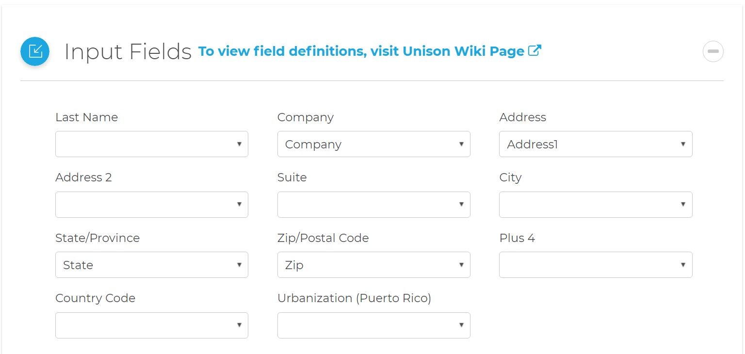
This section displays the possible inputs for the Address Service. An address and ZIP code are required.
- Last Name
- The last name of the individual associated with the address.
- Company
- The company or organization.
- Address
- The first address line.
- Address 2
- The second address line. This is optional and can contain a suite or a different secondary address, like a P.O. Box.
- Suite
- Sub-Premises. The suite number.
- City
- Locality. The city name.
- State/Province
- Administrative Area. The state or province name.
- Zip/Postal Code
- The five-digit ZIP Code, the first five digits of a ZIP+4, or a full nine-digit ZIP+4.
- Plus 4
- The last four digits of a ZIP+4.
- Country Code
- The country code.
- Urbanization (Puerto Rico)
- Only used for addresses in Puerto Rico. This is used to break ties between similar addresses in the same Postal Code.
Output Fields
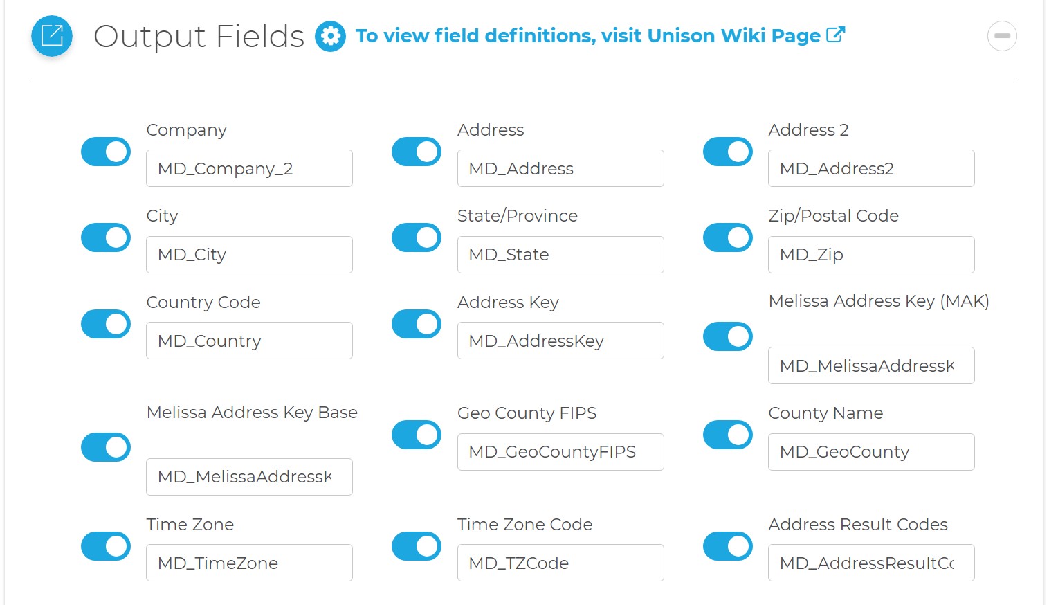
This section displays the possible outputs for the Address Service. Select the on/off toggle to enable/disable the output of a field.
- Company
- The company or organization.
- Address
- The first address line.
- Address 2
- The second address line. This can contain a suite or a different secondary address, like a P.O. Box.
- City
- Locality. The city name.
- State/Province
- Administrative Area. The state/province name.
- Zip/Postal Code
- The Zip or postal code.
- Country Code
- The standard code of the country.
- Address Key
- Returns a unique key for the current address.
- Melissa Address Key (MAK)
- (MAK) A unique key assigned to an address record.
- Melissa Address Key Base
- A unique key assigned to the base address of a complex with apartments or suites.
- Geo County FIPS
- Federal Information Processing Standards codes used nationally to numerically identify a specific county or political jurisdiction.
- County Name
- The name of the county.
- Time Zone
- The name of the time zone associated with the time zone code.
- Time Zone Code
- A three-letter code for the locality (city) of the region associated with the phone number.
- Address Result Codes
- Returned result codes for the address.
Parsed Address Fields
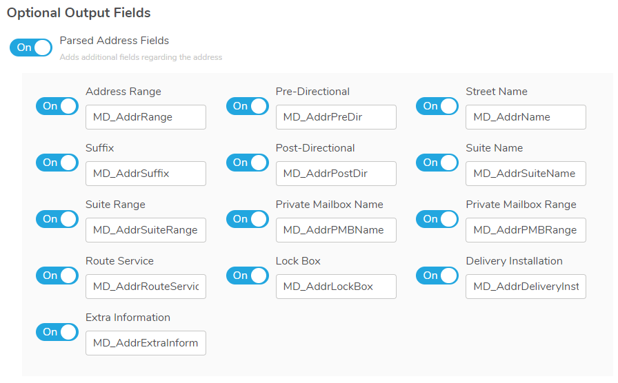
Adds additional parsed fields regarding the address.
- Address Range
- The street number.
- Pre-Directional
- Street Pre-Directional, Thoroughfare Pre-Directional. This is any directional indicators that precede the street name. The directionals are returned as one- or two-character abbreviations. If the input data contained "Southwest", it would be shortened to "SW".
- Street Name
- Thoroughfare Name. Only the street name, minus the suffixes or directionals. For "SW Main Street", this would return "Main".
- Suffix
- Trailing Type. The standard abbreviations for the street types: "RD", "ST", "AVE", "BLVD", etc.
- Post-Directional
- This is any directional indicators that follow the street name. The directionals are returned as one- or two-character abbreviations. If the input data contained "Southwest", it would be shortened to "SW".
- Suite Name
- Sub-Premises Name. The descriptive portion of the secondary address: "SUITE", "APT", "UNIT", etc.
- Suite Range
- Sub-Premises Range. The numeric portion of the secondary address.
- Private Mailbox Name
- The descriptive portion of the private mailbox number. A private mailbox, or PMB, is a secondary address associated with a Commercial Mail Receiving Agency (CMRA).
- Because the CMRA may itself be located in a suite, such an address may have both a suite number and a PMB number.
- The name portion of the PMB will normally be either "#" or "PMB".
- Private Mailbox Range
- The numeric portion of the private mailbox number.
- Route Service
- The route service number for a Canadian address. Route Service is typically used to designate an address in a rural area.
- Lock Box
- The lock box number for a Canadian address. Lock boxes are similar to PO Boxes and the terms are often used interchangeably.
- Delivery Installation
- The delivery installation information for a Canadian address. The delivery installation is the Canada Post facility that services the address.
- Extra Information
- This is any text from the street address column that does not fit into one of the above categories.
Additional Address Fields
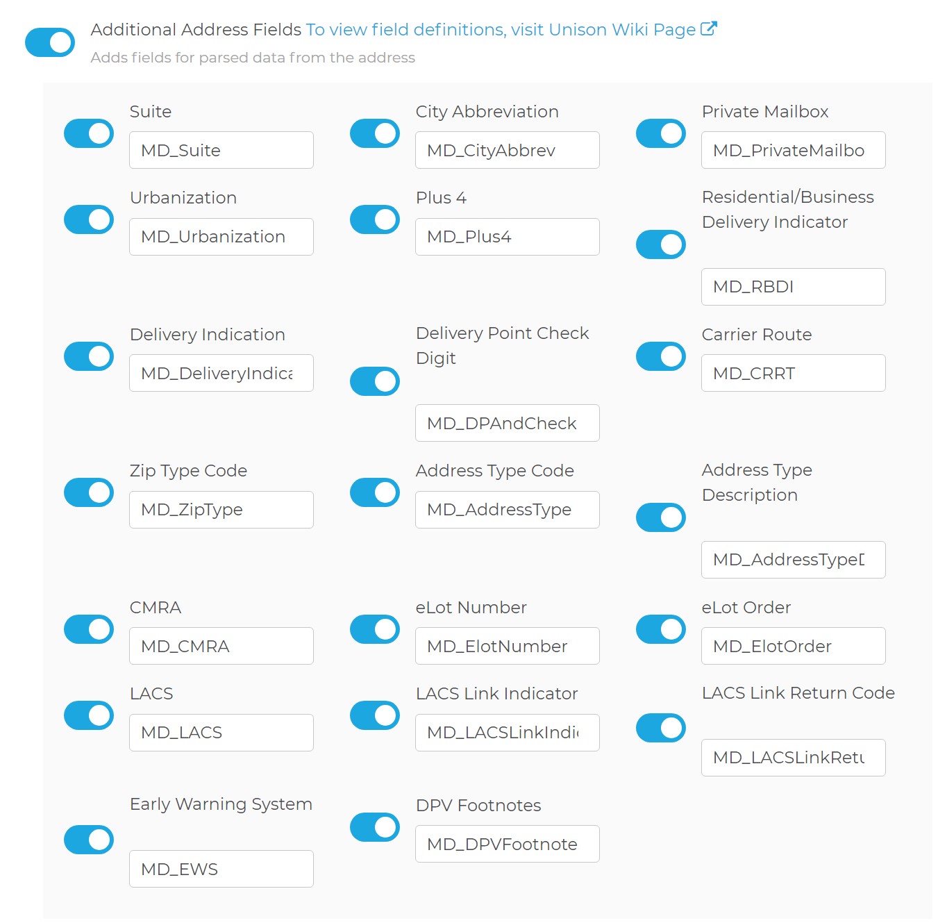
Adds fields for parsed data from the address.
- Suite
- Sub-Premises. This is the formatted suite information.
- City Abbreviation
- Locality Abbreviation. The official city abbreviation the Post Office™ has associated with the city or municipality name, if any is available.
- Private Mailbox
- The private mailbox. This will be populated if the primary address was identified as a Commercial Mail Receiving Agency (CMRA) and the secondary address information is present. This would also be populated if the secondary address information contains the string "PMB", thus identifying the address as a private mailbox.
- Urbanization
- Dependent Locality. This is used to break ties between similar addresses in Puerto Rico. The urbanization name tells the address checking logic which "neighborhood" to look in if more than one likely address candidate is found.
- If just one address is found, the address checking logic can correct the address and return the urbanization name.
- Plus 4
- The four-digit extension from the ZIP + 4®. If this column is not mapped the Plus4 will be appended to the ZIP column.
- Residential/Business Delivery Indication
- This is a one-character code indicating whether the submitted address is "R", a residence; "B", a business; or "U", the status is unknown.
- Delivery Indication
- Delivery Indicator indicates whether a given address is residential or business. Since some shipping rates are different for residential or business addresses, this information can potentially save a great deal of money.
- Delivery Point Check Digit
- The delivery point, when combined with the check digit, is a three-digit number that combined with the ZIP + 4, generates a unique number for each address in that ZIP + 4. This number is used to generate barcodes, so if you plan you use this address data for commercial mailing, it would be necessary to map an output column for this information.
- Carrier Route
- This is a four-character code that indicates which mail carrier delivers to the input address.
- The first character of this Carrier Route is always alphabetic and the last three characters are numeric. For example, "R001" or "C027" would be typical carrier routes. The alphabetic letter indicates the type of delivery associated with this address.
- Zip Type Code
- Postal Code Type The type of ZIP Code can indicate a specialized address, such as military or PO Box complexes.
- Address Type Code
- This is a one-character code indicating the type of address that was processed.
- Address Type Description
- This is a text description of the address type code.
- CMRA
- This indicates if the primary input address is a Commercial Mail Receiving Agency (CMRA), such as the UPS Store® or similar private mailbox business location.
- eLot Number
- This number indicates where the current address falls in the delivery order within the ZIP + 4®.
- The eLot columns may be required if you are sending the data on to be presorted for mailing using USPS® Standard Mail® rates.
- eLot Order
- The eLot Order returns the letters "A" or "D" to indicate whether the Post Office™ delivers mail within the ZIP + 4® in ascending eLot Number order or descending.
- Therefore, if the eLot Number is 1 and the eLot Order is "D", then the address is typically the last delivery of the day.
- LACS
- Some rural route addresses are converted to city-style addresses to allow emergency services (ambulance, police, fire, and so on) to find these addresses faster.
- LACS Link Indicator
- The LACSLink service matches the old address with the updated address and corrects it as part of the address verification process.
- Not using LACSLink processing will speed up processing, but the Component will not update addresses that have changed.
- LACSLink processing is required to generate a CASS Form 3553.
- LACS Link Return Code
- This is a return code for the status of the LACS Link service.
- Early Warning System
- EWS. USPS System that flags addresses when they are scheduled for inclusion in the USPS database but are not added yet. The addresses are typically new high rises, or new housing subdivisions that are being assigned deliverable mail addresses.
- DPV Footnotes
- The DPV footnotes indicate the level of matching between the current address and the USPS’s DPV database. The footnote may be up to six characters long.
DPV Address Status Codes
Code Description AA Input Address Matched to the ZIP + 4 file A1 Input Address Not Matched to the ZIP + 4 file BB DPV matched (all components) CC Primary Number Match – Secondary present but invalid F1 Address Was Coded to a Military Address G1 Address Was Coded to a General Delivery Address M1 Primary Number missing M3 Primary Number invalid N1 Primary Number Match – Secondary missing P1 Missing PO, RR or HC Box number P3 Invalid PO, RR or HC Box number R1 DPV matched to CMRA – PMB number not present RR DPV matched to CMRA U1 Address Was Coded to a Unique ZIP Code
Geographic Information
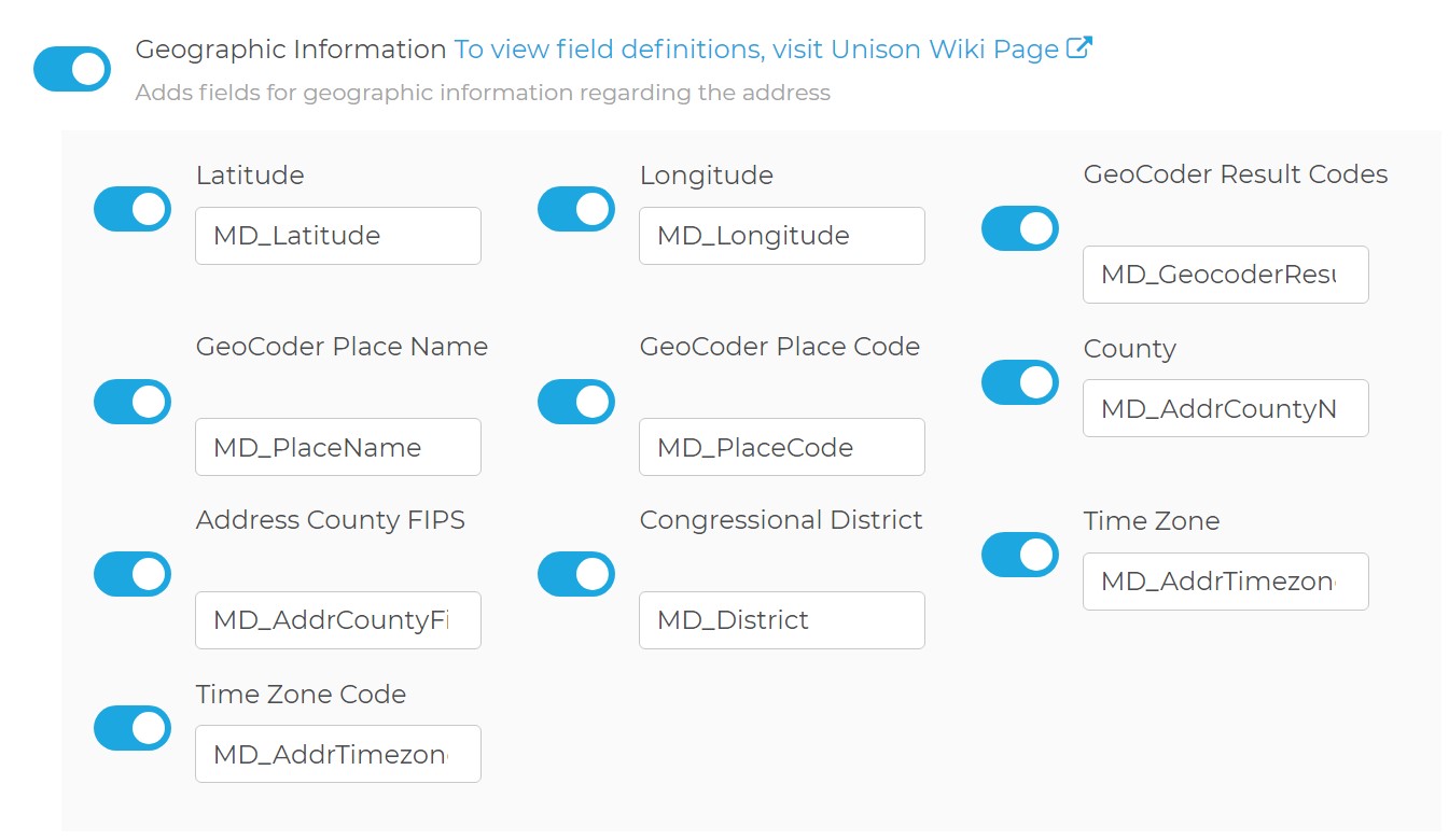
Adds fields for geographic information regarding the address.
- Latitude
- Returns the geocoded latitude for the address.
- Longitude
- Returns the geocoded longitude for the address.
- GeoCoder Result Codes
- Returned result codes for the geocoding portion of the address.
- GeoCoder Place Name
- The official Census Bureau name for the location indicated by the Place Code.
- GeoCoder Place Code
- The Census Bureau Place Code for the physical location of the input address. This information is useful when the boundaries of the ZIP + 4 overlap city limits.
- County
- Sub Administrative Area. The county name.
- Address County FIPS
- Sub Administrative Area FIPS Code. The 5-digit County FIPS code. The first two digits indicate the state while the last three digits indicate the county within the state.
- Congressional District
- The 2-digit code indicating the address's congressional district.
- Time Zone
- The name of the time zone where the address is located.
- Time Zone Code
- The one- or two-digit number code for the time zone where the verified input address is located. The number also indicates the number of hours that the time zone is behind UTC/GMT. In other words, Eastern Standard Time has a time zone code of 5, indicating that the Eastern time zone is five hours behind UTC/GMT.
- This number does not indicate differences due to daylight savings time.
Census Details
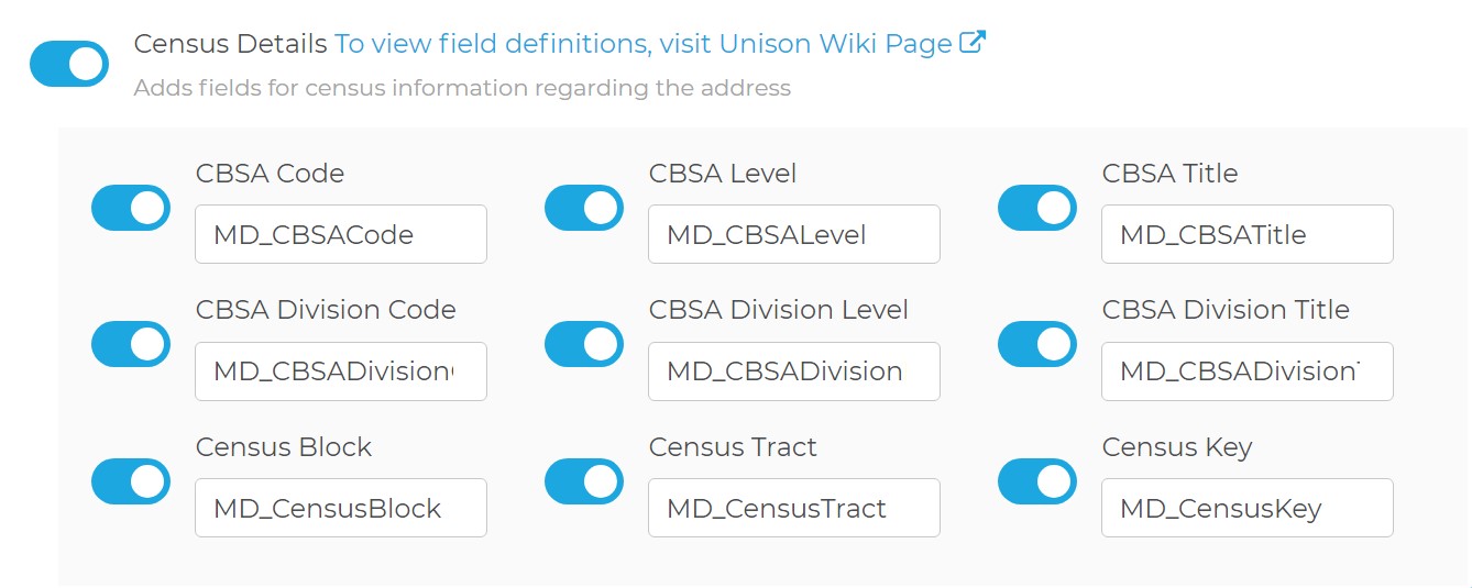
Adds fields for census information regarding the address.
- CBSA Code
- A five-digit code for the specific Census Bureau CBSA (Core-Based Statistical Area).
- CBSA Level
- The CBSA code level. If present, the CBSA Level will be Metropolitan or Micropolitan.
- CBSA Title
- The CBSA Title describing the CBSA code.
- CBSA Division Code
- A code representing the CBSA division associated with the address.
- CBSA Division Level
- The CBSA Division code level. If present, the CBSA Division Level will be Metropolitan or Micropolitan.
- CBSA Division Title
- The CBSA Division Title describing the CBSA Division code.
- Census Block
- This is a 4-digit string indicating the Census Block number associated with the address. Census Blocks are the smallest geographic area for which the Bureau of the Census collects information.
- Census Tract
- This is a 4 to 6-digit string containing the Census Tract number associated with the address. Census Tracts are small subdivisions of the county.
- Census Key
- Returns a 15 digit string containing the concatenated County FIPS, Census Tract and Census Block.
Address Task Settings
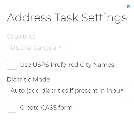
Use the Address Task Settings to control USPS preferred city names, diacritics, and CASS forms.
- Countries
- This is locked to US and Canada. To select other countries, use the Global Address Cleansing Task.
- Use USPS Preferred City Names
- For every city, there is an official name that is preferred by the U.S. Postal Service. There may be one or more unofficial or "vanity" names in use. Normally, the Component allows you to verify addresses using known vanity names. If this box is checked, the Component will substitute the preferred city name for any vanity name when it verifies an address.
- Diacritic Mode
- This controls how the Component will handle diacritic characters in French words for addresses located in Quebec. The default setting is for the Component to return data with diacritic characters if they were already present, otherwise not. The other settings are to always return data from Quebec addresses with diacritic characters, even if they were not present in the input data, or to always replace the diacritic characters if they were present in the input data.
- Create CASS form
- US Only. Enable this to generate a CASS Form 3553 after processing all records.
- This requires the address information boxes be filled out with the contact information for the company that owns the data being processed.